
Mountain Bike Routes: Complete Planning Guide
Planning the right mountain bike route means balancing terrain difficulty, elevation, and weather. Wind is the hidden factor most riders ignore—until it costs them time or energy.
Most riders choose mountain bike routes on distance, elevation gain and technical difficulty. Those matter. But there is a variable that quietly ruins rides and drains your legs, and that is the wind. A headwind on a rocky descent does not feel dramatic, yet it slows you and taxes your shoulders. A crosswind on an exposed ridgeline forces constant small corrections. And a tailwind on a fire road climb is one of the few gifts the weather gods hand you.
The trouble is that wind is not the same across a route. It shifts with the terrain, the exposure, the altitude, the time of day and the season. A valley floor feels sheltered. A ridge top traverse gets hammered. Most route planners, Strava, Komoot, a standard GPS watch, show you the climb and the mileage. They do not show you when the wind hits hardest or which sections will drain you fastest because they are exposed.
Why Wind Matters on Mountain Bike Routes
Air resistance rises steeply with speed. A 5 km/h headwind does not cost you 5% more effort. It costs closer to 12 to 15% more power, depending on your position and speed. On technical ground, where you are already working to manage grip and line choice, that extra load piles up fast.
Mountain biking adds another layer, exposure. Plenty of MTB routes climb through sheltered forest, then cross open ridges or drop into wind exposed clearings. A route with 800 m of climbing can feel easy if the climbing happens on shaded, protected trails, and brutal if the same gain crosses open terrain where the wind never lets up.
Wind also changes your confidence and your lines. A strong crosswind on a narrow, rocky section makes you hesitant. You brake earlier, lose momentum and work harder to get it back. That does not show up on a power meter, but your legs feel it.
Reading Terrain to Predict Wind Exposure
You cannot know the exact wind days ahead. But you can predict exposure by reading the map and understanding how terrain blocks or funnels wind.
- Valley floors and wooded sections. Sheltered. Spend your energy on the climbing and the technical bits, not on fighting the air.
- Ridge tops and bare summits. Maximum exposure. Expect the wind to pick up and save some mental energy for it.
- South and west facing slopes. Often more exposed than north facing ones in many climates. Learn your local patterns.
- Saddles and passes. Wind funnels through the low points, so exposure is usually higher than the ground around them.
- Descents in clearings. The technical difficulty drops but the exposure rises. Easier lines still demand stability.
Reading a contour map for wind takes practice. Tight contours mean steep, often wooded ground, which is sheltered. Spaced out contours on open ground mean exposure. Use it to plan the shape of your ride. Put your hardest technical sections in protected terrain, where you can focus on your line instead of the wind.
Elevation Gain and Wind, the Compounding Factor
Wind gets stronger with altitude. As a rough rule, it climbs by about 10 to 15% for every 500 m of gain in open terrain. This varies a lot with local geography, but it is a useful guide. A ridgeline climb across exposed ground faces stronger wind than a valley climb lower down.
That is why a 600 m climb on a coastal plain feels nothing like 600 m on an alpine plateau. The plateau route brings both longer exposure and stronger wind. Plan for it. If the forecast is windy, pick the route with less altitude and more shelter, even if it is longer.
Timing Your Ride for Wind
Wind is usually strongest in the afternoon and calmest early in the morning. If you have the flexibility, ride your MTB routes early. You dodge the peak wind, and the traffic and heat too. Morning air is steadier, and you feel it on the exposed sections.
Seasons matter as well. Spring and autumn tend to be windier in most regions. Winter is often calmer but with short daylight. Summer gives you long, steady days, though the heat and afternoon thermals can stir up wind. Check the typical pattern for the month you are planning, not just the forecast.
Using MoguWind Plan to Scout the Wind
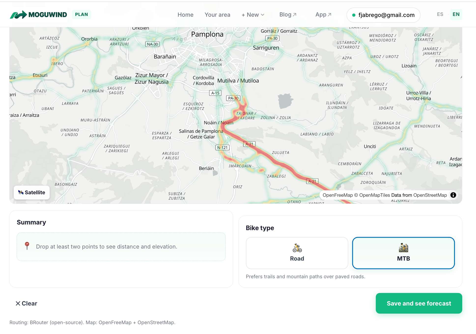
MoguWind Plan fixes the blind spot in MTB route planning. Instead of guessing where the wind will bite, you import your route and see the forecast for every kilometre, at the exact time you plan to ride. That is gold on the mountain bike, because exposure flips so fast. You might drop into a sheltered valley and climb straight back out into a headwind within 5 km.
You add your route, importing from Strava, drawing it in the planner or pasting a GPX, and set your start time. The tool works out the wind speed and direction for each part of the route from the location and your climbing pace. You see where the headwind lands on the climbs, where the descents catch it and where you can recover in shelter. With that, you make better calls. Swap an exposed ridge for a wooded line, shift your start time to dodge the afternoon peak, or just get your head ready for the hard bits.
Import your trail route and see where the wind hits before you ride it.
Scout your route with MoguWind Plan →The MoguWind app for Garmin takes it onto the trail. As you ride, it shows the wind live on your device, so you know what is coming on the next climb or descent. Instead of getting jumped by a headwind on an open section, you ride it with the right pacing and the right expectations.
See the wind live on your Garmin on every climb and descent.
Get MoguWind for Garmin →A Practical Checklist for MTB Route Planning
- Map the terrain. Spot the sheltered and exposed sections using the contours and the land cover.
- Look at the climbing. Favour routes where the climbing sits in protected terrain.
- Pick your timing. Ride early when you can and avoid the afternoon peak.
- Scout the wind. Use MoguWind Plan two or three days out to see the wind section by section, and shift your time or route if heavy headwinds are coming.
- Know the season. Learn whether spring or autumn is windier where you ride, and plan around it.
- Test and learn. After each ride, note where the wind was a factor. Over time you build a mental map of your local routes.
MTB route planning is more than elevation and distance. Wind, exposure and timing shape the whole day. Read the terrain for exposure, check the forecast with the right tool, and time your ride with a bit of thought, and you turn a frustrating slog into a day where you ride with the conditions instead of against them. Faster times, saved energy and a lot more fun on the trails.
Keep reading about planning routes with wind.